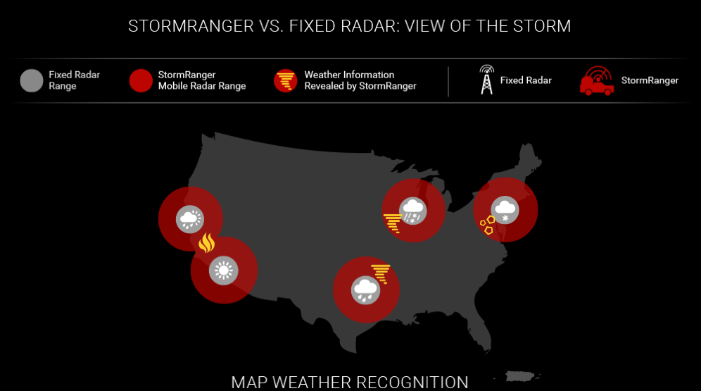
The StormRanger mobile radar truck is a one-of-a-kind vehicle that has a live, high-powered Doppler radar enabling it to get out ahead of a storm. StormRanger can track storms wherever they are with a higher degree of accuracy and more detail than ever before.
How StormRanger Gives You The Most Accurate Storm Information
StormRanger is a Doppler radar on wheels. It can easily move to where the storm is headed and fills in gaps left by the current fixed radar network.

Location of the radar closer to the ground allows us to see into a storm in a way that radar mounted tens or hundreds of feet higher can’t.

The shorter 75-mile range and faster rate of rotation ensures faster updates, better accuracy, and quicker detection of changes in storm structure – which means a more detailed look into the gaps other radars miss.

The high-resolution, dual-pol radar beam allows detection of snow, hail, and even the debris field associated with a tornado.
StormRanger is another tool in our expanding weather arsenal designed to keep you and your family safe when severe weather strikes. From increased visibility in the heart of a storm to the ability to alert people in real time that a tornado has touched down because it can detect actual debris on the ground.

By driving StormRanger close to actual storms, your local NBC market will be able to give a detailed look that TV stations never have been able to do before. Fixed radars may miss certain weather events due to terrain. But StormRanger can fill in those gaps in coverage, and in turn provide a more complete picture of what is happening now and what those immediately in the crosshairs of a severe storm can expect.

Why StormRanger Makes a Difference

Tornadoes
When there is a threat of a tornado, a StormRanger can detect much more than a fixed radar is capable of thanks to its state-of-the-art polarization Doppler radar system. The dual polarization allows meteorologists to detect debris in the air and types of precipitation.
Being able to see that debris signature -- what we call a debris ball -- from a tornado allows meteorologists and viewers to understand that there is a tornado on the ground causing damage and kicking up debris, and that is all seen on the StormRanger radar.

Snowstorms
During snowstorms, StormRanger can help provide a more accurate outlook on snowfall measurements by finding the rain/snow line — that area where rain can turn into ice or snow. Identifying those in-between areas can mean a world of difference when it comes to predicting whether an area will receive just an inch or two of snow as opposed to 12 inches or more.

Fire
During fire season, StormRanger can be an asset to the public as well as fire departments and government leaders to better alert he StormRanger’s X-band radar is able to detect much smaller particles.


